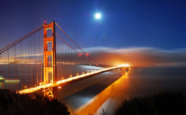
Guidebook America:
Now with 10000
pages of travel information and an
exclusive
travel
directory
with over
15,000 listings Worldwide;
Accommodations:
hotels, bed and breakfasts, vacation rentals, and
more. Recreation:
rafting, sailing, fishing, biking, balloon rides,
gliders and more.
Shopping, dining, real estate, the list goes on and
on...
Scenic WebCams
Don't forget to check out our WebCams area for some
really nice cams. Two of our favorites: The
"Hollywood Sign" Cam and the Grand Canyon Cam.
Guidebook Cape Cod ~ Chatham
The ‘Chatham Break.’ In January 1987, a powerful nor’easter unexpectedly
broke through the lower end of Nauset Beach, allowing the Atlantic Ocean
to surge into Chatham Harbor. This was christened the ‘Chatham Break.’
The ‘Chatham Break’ is a growing ocean channel between Nauset Beach and
Monomoy Island. Onlookers can see the channel from telescopes mounted at
the foot of Chatham Light. Chatham Harbor had been shielded from surges
of the open Atlantic Ocean by the lower end of Nauset Beach, a barrier
beach. Although a barrier beach protects one body of water from another,
it is essentially a frail piece of land subject to erosion by fierce
winds and powerful tides. A section of Nauset Beach at Chatham Harbor
had been undergoing this weakening process for some years. When the
Janaury 1987 storm hit, the raging ocean, pushed by an unrelenting wind,
tore open the land at this vulnerable point and the Atlantic flowed into
Chatham Harbor. This phenomenon was somewhat similar to the legendary
Dutch boy taking his finger out of a hole in the dike and letting the
North Sea flood a part of Holland.
This breach of the barrier beach is responsible for strong and dangerous
currents and considerable wave action, all of which can make both
boating and swimming somewhat dangerous. Notwithstanding the ‘Chatham
Break,’ as it has been christened, it has brought many visitors into
town to observe the phenomenon. In the years since the ‘Break,’ the
newly created island, South Beach, has already glommed onto the
coastline, becoming a peninsula. This is one landscape that rarely stays
put for long.
Monomoy Natural Wildlife Refuge is a preserve which takes in 2,750 acres
including the Monomoy Islands, a fragile nine-mile long barrier beach
area south of Chatham, was created during a fierce storm in 1958. These
islands are a major stop along the North Atlantic Flyway for 285 species
of migratory waterfowl and shore birds. North Monomoy has dunes, beach
grass, migrating birds and a large summer population of eastern shore
birds. South
Monomoy, considerably larger, features a wide array of flora and fauna,
including deer and seals. Hundreds of harbor seals carpet the coastline
from November to May. The Refuge’s visitor center, located on Morris
Island, is open daily from 8am to 5pm.
Chatham Light, Shore Road and Bridge Street. This 1808 lighthouse
replaced the earlier two lights (known as the “Twin Sisters of
Chatham”). Exceptional views can be found here and the famous Chatham
fogs make it a wonderful aerie for photographers. Beneath these waves
are some of the most dangerous waters along the Cape Cod coast. In 1808
two wooden lighthouses were built on a cliff in Chatham east of the
location of the current Chatham lighthouse--a cliff that no longer
exists. These first two Chatham lights were range lights, meaning they
were movable and could be aligned in such a way that mariners
approaching Chatham by sea could find the channel to the harbor by
lining up the two lights. By 1841, the cliff had eroded so much that
both lighthouses tumbled to the beach below. Another pair of
lighthouses--these made with brick and mortar--were constructed to
replace the old ones, but the cliff continued to erode at a rate of 20
feet per year until these were also destroyed in 1879 and 1881. To
replace this second set, two iron lighthouses were built. One is the
current Chatham Light, the other was moved to Eastham in 1923 to become
the current Nauset Light. Chatham Light overlooks the Chatham Break, a
mile-wide hole in the barrier beach that stretches back to the mainland
at Nauset Beach in Orleans. The break occurred in early 1987 during a
fierce nor’easter.
Chatham Fish Pier, Shore Road and Bar Cliff Avenue. Just down the road
from the Chatham Light is the Chatham fish pier, where there’s always a
small crowd gathered on the visitors deck (best viewing is between 12
noon and 2pm, when the fishing fleet is returning). Not only does the
pier offer a great view of Chatham's harbor and outer beach with the
Atlantic beyond, but when the fishing boats unload their catch, both
children and adults get a fascinating glimpse of the Cape's best-known
industry. A working pier with an observation deck to provide great views
of fishermen and the town’s active fishing fleet in action. The Pier is
also the center for commercial and sports anglers. Aunt Lydia’s Cove
(off Shore Road)
Old Atwood House & Museum, 347 Stage Harbor Road. This 1752 building,
one of Chatham’s oldest, was home to five generations of Atwoods. It has
been the headquarters of the Chatham Historical Society since the 1920s.
Within the Museum are many historic collections and furnishings,
including the Joseph C. Lincoln Room, a repository of the prolific
author’s books and memorabilia including murals of artist Alice
Stallnecht, an old reflector from Chatham Light, antiques and glass.
Summers.
The Railroad Museum, 153 Depot Road. Domiciled in the old Victorian
Chatham Railroad Company station which was active from 1887-1937 (on the
National Register of Historic Places), the diminutive museum exhibits
antique railroad equipment and memorabilia. On the appropriately named
Depot Street is Chatham's Railroad Museum. Built in 1887, the Museum
operated as a train depot until 1937, servicing more than 20,000
passengers per year. It was donated to the town in the 1950s and is
today a museum offering a wide variety of railroad-related items that
are sure to delight railroad buffs. The building, listed in the National
Register of Historic Places, offers displays of antique equipment and
memorabilia as well as a caboose dating from 1910. It is open weekdays
from 10 AM to 4 PM, mid-May through the first week of September, and
there is no admission fee, though donations are accepted.
Old Godfrey Windmill, Off Shattuck Place (near Chase Park). Built in
1797 by Colonel Benjamin Godfrey, this wind-powered mill grinds corn.
This wind-powered grist mill was built along Stage Harbor Road in 1797
by Colonial Benjamin Godfrey. The mill ground corn until 1898. Over the
course of the 20th century it was twce damaged by storms and was closed
until 1956 when it was given to the town. The mill was then moved to its
current location at Chase Park. It is open every day except Tuesday
throughout July and August. This is one of those look-see attractions
with no admission fee charged.
Monomoy Theatre, 776 Main Street. The Cape’s second oldest surviving
stage, this former toy factory became an Equity theater in the 1930s. In
1957, it was taken over by the Ohio University Players and is now a mix
of students from around the country and returning alumni. The theater
seats only 276 patrons and all have a great view. The Ohio University
Players present a different play every week during its summer tenure
here.
Cape Cod Chamber of Commerce
Routes 6 & 132, PO Box 790
Hyannis, MA 02601
508-362-3225 |
Website
|
Email
For
information about accommodations, recreation, dining and much
more in this area and many other US destinations, take a moment
to visit our US Travel Directories: